Weather swings back to winter Sunday in NYC. Here's when it will warm up again.
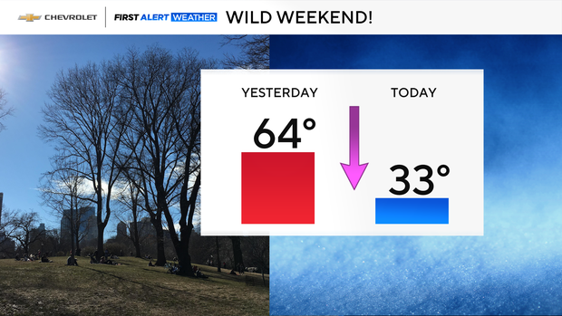
A wild weather weekend continued in the New York City area. After climbing into the 60s Saturday, wind chills early Sunday morning were only in the single digits.
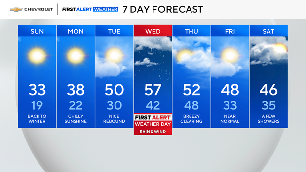
Sunday forecast
Highs during afternoon were 30-plus degrees colder than Saturday, topping out in the low 30s. With a brisk northwest wind gusting 25-30 mph at times, it felt more like the low 20s at best.
Despite the frigid temperatures, there was plenty of sunshine.
Expect another cold night with temperatures falling into the teens and low 20s around the Tri-State Area. It won't be quite as gusty, but wind chills will still be a few degrees lower than the actual air temperatures.
The week ahead
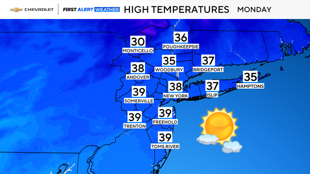
Temperatures remain below normal Monday, but it won't be as harsh. There will be mostly sunny skies with highs in the mid to upper 30s.
It will stay quiet on Tuesday as we warm back up to around 50 degrees. Clouds will start filtering in during the second half of the day, but it stays dry.
Tracking a rain storm
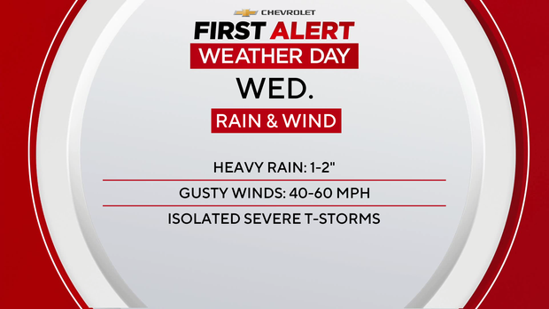
Wednesday will be our next First Alert Weather Day as a potent system moves through the Great Lakes. A warm front in the morning will bring some showers with temperatures rising into the upper 50s. A period of steadier rain and gusty winds is likely into the afternoon and evening.
Stay tuned as we get closer, but plan on a tricky evening commute Wednesday.