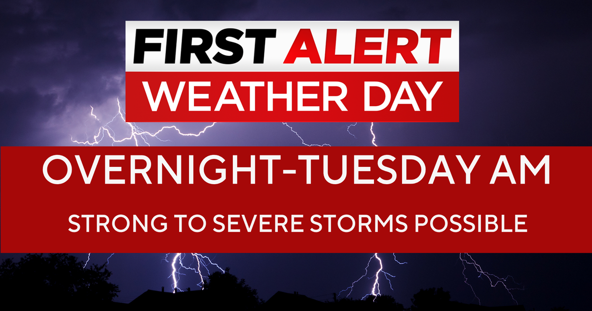
First Alert Weather Day ends tonight at 9 p.m. in North Texas
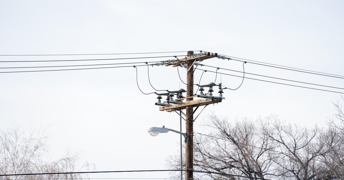
It has been a wild Mardi Gras for North Texas, weather-wise. Early this morning, Mother Nature unleashed Category 1 hurricane-force winds with severe storms sweeping across the region. The area witnessed extensive damage, including tossed trailers, mangled roofs, and downed trees and powerlines.
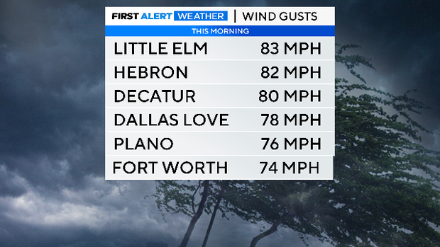
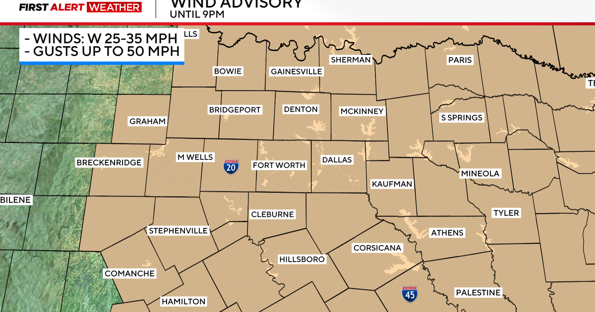
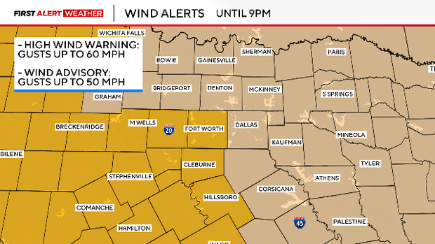
Non-thunderstorm winds were also quite impressive during the afternoon after the front passed through, topping out around 67 mph in Denton. The winds will remain powerful throughout the rest of the day, which is why the National Weather Service has issued wind alerts that will stay in place until 9 p.m. Tuesday evening.
Also, please remember to avoid any activities that may cause a spark or a flame due to high fire danger. Any flame that ignites will spread rapidly.
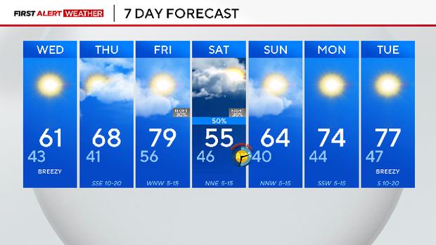
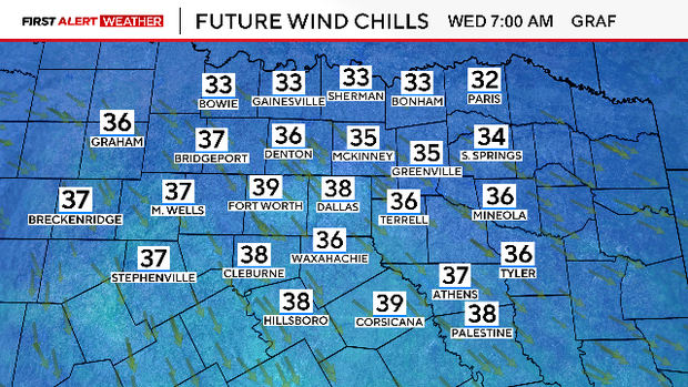
On Wednesday, the winds will be blowing but not as hard. During the morning, winds will be from the northwest at 10 to 20 mph, with gusts around 30 mph. The breeze combined with the cooler airmass will lead to the windchill or the "feels-like" temperature to be in the upper 30s. Be sure to bundle up.
The chilly conditions won't last long. Temperatures will climb well above average by Friday, reaching nearly 80 degrees. However, the First Alert Weather Team is watching the next big weather maker, which will move through Friday into Saturday. This system will bring another cold snap and a chance for rainfall.