Soaking rain storms through Wednesday in Chicago
Weather alerts last through Wednesday as soggy conditions continue across the Chicago area.
Highs will be in the 50s on Tuesday with waves of rain expected to build throughout the day and into the evening.
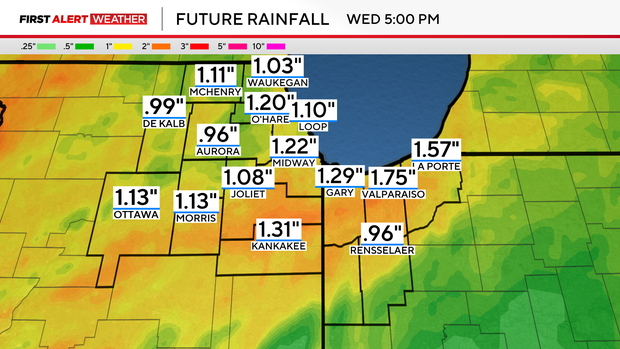
Rainfall amounts could reach as high as two inches and there is an elevated risk of river rises and a threat of flooding in flood-prone areas.
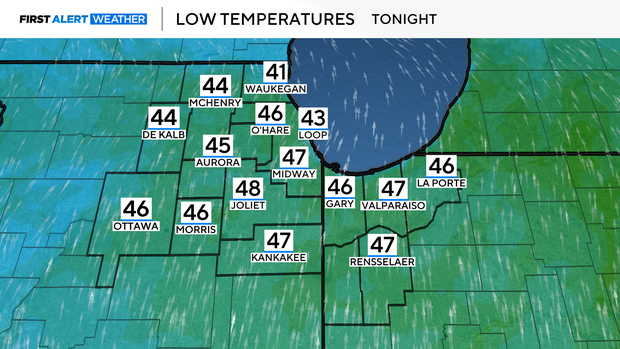
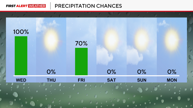
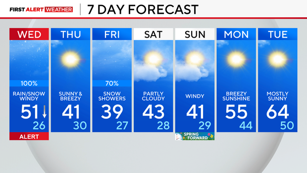
On and off rain will continue Tuesday night, with low temperatures being very steady in the 40s. Rain sticks around through the first half of Wednesday before temperatures start to drop off during the afternoon and evening. Temperatures cool down enough to create snow showers starting late in the afternoon.
Accumulations will remain minor for any snow. If anything, a dusting towards half an inch is possible. Rain could add an additional .5" to 1" to what we already received, which will create more flood concerns. Remember to never drive through a flooded roadway.
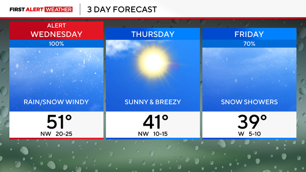
A break from the precipitation arrives on Thursday with sunny skies, but Friday another storm system impacts Chicago. That system looks a little more snowy, so stay with your First Alert Weather team for updates.
Temperatures rebound next week, with highs back in the 50s and 60s.
Forecast at a glance
Tonight: rain continues. Steady temps in the 40s. Turning breezy, areas of fog.
Tomorrow: falling temperatures. Rain to start changing over to snow. Windy, gusts near 40 mph.
Tomorrow night: drying out. Clouds decrease. Low of 26.


